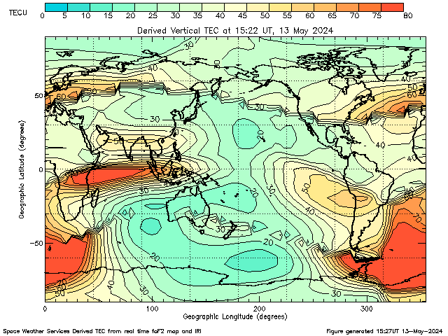
Ionospheric
TEC of the Day
GOES Magnetometer Data for today
TEC of the Day
TEC of the Day from NASA JPL
GOES Magnetometer Data for today
Since
1975, each of NOAA’s Geostationary Operational Environmental Satellites
(GOES), located in Earth’s geographic equatorial plane, approximately
6.6 Earth radii from the center of Earth, have carried magnetometers to
monitor the geomagnetic field and its variations. Typically there are
two GOES operational satellites: GOES East, located over the east coast
of the U.S. and GOES West, located over the Pacific, just west of the
U.S. mainland. At times, though, data are available from more than the
two prime operational satellites.
The geomagnetic field measurements are important for interpreting GOES energetic particle measurements and for providing alerts to many customers, specifically for indicating the onset of a geomagnetic storm (known as a sudden storm commencement). GOES magnetometer data have been used for constructing magnetic field models, and to help forecasters identify the buildup and release of energy in Earth’s magnetosphere that occurs during geomagnetic storms and substorms. The magnetic field measurements can also indicate when the solar wind has pushed the boundary of the magnetosphere, the magnetopause, inside of geosynchronous orbit. Those situations are usually during very disturbed space weather conditions and can be important for spacecraft operations.
GOES Magnetometer data are also important in research, being among the most widely used spacecraft data by the national and international solar and space weather research community (see e.g. NASA CDAWeb usage statistics). The data have often been used to support launch decisions for research sounding rockets. The measurements can also be used to validate large-scale space environment models of the coupled magnetosphere and ionosphere; SWPC will implement such a model in the near the future.


No comments :
Post a Comment